![]()
[Home]
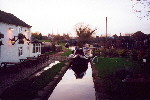
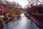
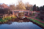
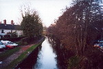
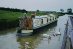
To view information about a specific canal, click on the relevant link below:
| The
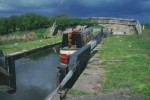
Trent and Mersey (Grand Trunk) canal
The idea of this canal was to join the Mersey to the Thames and then another canal would join the Trent to the Severn. These joins would create a link between the four major ports of London, Liverpool, Bristol and Hull and form a 'Grand Cross'. Brindley had also planned other branches to Manchester, Birmingham, Coventry and Derby. Brindley had done a survey in 1758 for a canal for Earl Gower and Lord Anson but it proved to be too expensive and unfeasible to build. However, due to the success of the Worsley to Manchester section of the Bridgewater Canal and its realignment to join with the proposed Grand Trunk Canal which would give the Bridgewater canal access to the Potteries, Hull, London and Bristol, the Duke of Bridgewater backed up the revived proposals. Josiah Wedgwood also knew Brindley and was aware of his great talent. Wedgwood was in favour of the proposed Grand Trunk Canal because transporting his products to his customers was a slow process by horse and cart and often resulted in breakages. Similarly, obtaining his raw materials such as flint from south-east England and china clay from Cornwall was a slow and expensive process. This meant that this canal would offer Wedgwood great advantages in the area of transportation. He promised one thousand pounds for starting costs for the canal and also invested in a large number of its shares. Despite rival schemes being proposed, the Grand Trunk Canal prevailed and Wedgwood cut the first sod of the canal at Brownhills near Tunstall on the 26th July 1766. Brindley predicted that the whole canal would be complete by the end of 1772 but there were added complications in the form of Harecastle Hill. Brindley decided that the best route was to go through the hill and to therefore construct a tunnel. This proved to be a very difficult and time-consuming process. The Staffordshire and Worcestershire Canal Act was passed at the same time as the Trent and Mersey Canal act - on the 14th May 1766 - and was completed by May 1772. A stretch of the Trent and Mersey from Wilden Ferry on the Trent to Stoke had also been completed at this time, which meant that Brindley saw two arms of his Grand Cross scheme completed before his death, linking the Potteries with the major ports of Bristol and Hull. The Trent and Mersey was completed and opened in 1777, five years after the completion date that Brindley had predicted and also five years after his death.
|
|
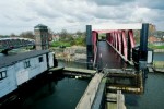
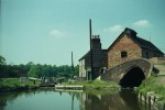
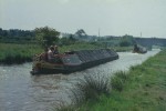
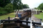
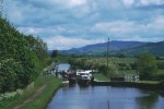
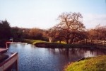
The Bridgewater Canal The Bridgewater Canal was a unique development as it was the first arterial canal. This means that instead of running parallel to the banks of a river (lateral canal) it crosses valleys by using features such as tunnels, cuttings, embankments and aqueducts. This was not Brindley's first canal as he had been working on the Trent and Mersey Canal, but it was the first of his to be constructed (work on the Trent and Mersey canal didn't commence until 1766). The Duke of Bridgewater (Francis Egerton) owned several coal mines in Worsley but these could not reach there full potential of generating high profits due to the high costs of transporting the coal by horse and cart. The Duke therefore decided to build a canal directly from Worsley to Manchester. Although an act had been obtained to build a canal from Worsley to the Mersey and Irwell navigation as early on as 1737, nothing had actually been done on it. It also appears that a survey had never been carried out, and so it was at this point that the Duke invited Brindley onto the project. Brindley accepted and spent six days from the 1st July 1759 working at Worsley on the survey of the Worsley to Manchester section. He considered the Duke's idea to terminate the canal at Salford, but then proposed a great improvement. Brindley suggested that the canal go from Worsley to Stretford joining there with one of his proposed canals, which he was in the process of designing, running from Manchester to the Grand Trunk (better known as the Trent and Mersey). This would make the full connection from Worsley to Manchester but would more importantly connect Manchester with everywhere else, Liverpool, London, Birmingham, and all of the other places that radiate from the Grand Trunk. Brindley had envisaged this network of canals from the beginning and they were all started in the next few years. The Duke of Bridgewater was very impressed with these proposed plans and therefore abandoned the Salford scheme and commenced working on the new route. The Worsley to Manchester section of the Bridgewater Canal was completed in 1761. However, Brindley was still supervising the construction of other sections of the canal in 1764 and it was not fully completed until 1776 because certain landlords held up construction as they were not content with the canal cutting through their land. One of the main features of the Bridgewater Canal was the Barton Aqueduct. Originally the canal was to be built on one level apart from using locks to lower the canal to the river Irwell and then raise it on the other side. However, Brindley and the Duke then considered the idea of building an aqueduct instead. The Duke had seen one of these when abroad but it was a new idea to England. His friends therefore didn't think that he would be able to build the structure and advised him not to throw his money away. Despite the opposition, Brindley and the Duke went ahead with the scheme and on the 17th July 1761 barges of coal from the Duke's collieries at Worsley were crossing the Barton Aqueduct on their journey to Manchester. This aqueduct became a wonder of the age and people travelled long distances to see the structure. Another noticeable feature constructed by Brindley on the Bridgewater Canal was the terminus at Castlefield. This consisted of the river Medlock flowing partly into the Bridgewater canal. The rest of the water flowed down into an underground tunnel underneath the Bridgewater canal to join with the river Medlock at a lower level on the other side. The water that fell into the underground tunnel provided a power source, which was used in several ways. One of the uses was to power wheels that in turn allowed coal to be hoisted up to street level at Castlefield.
|
|
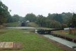
The Coventry Canal This canal was to run from Fradley Junction near Lichfield to Coventry (thirty-eight miles from Fradley). At Longford (thirty-four miles from Fradley), was the junction with the Oxford Canal. Brindley and his staff made the survey for the canal and obtained the approval of Parliament in January 1768. Work on the canal commenced in December 1768 and soon after this the Coventry Canal Company was set up to build the canal. Its first meeting was on 19th February 1769, but Brindley was dismissed from the Company on 12th September 1769 mainly due to his high standards of construction, which were too expensive. The Coventry Canal Co was running very low on money and they only managed to get as far as Atherston (sixteen and a half miles from Fradley) by the end of 1771. At this point construction of the canal ceased for seventeen years. The Canal was completed and opened in 1789.
|
|
The Oxford Canal The Oxford Canal was to leave Longford, where it joins with the Coventry Canal, and run down to Oxford joining there with the Thames. The survey was carried out and the parliamentary plan (which was prepared by Brindley's assistant) was approved in 1769. The Oxford Canal Company was formed and they held their first meeting on 1st May 1769. At this meeting Brindley was appointed the position of Engineer and Surveyor for the Canal. Construction started in 1769 and the plan was for the canal to be eighty-two miles long, although when it was finished it was actually ninety-one miles long. It was opened in 1793 and this marked the completion of Brindley's 'Grand Cross'.
|
|
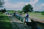
The Droitwich Canal The Droitwich Canal was surveyed by Brindley, and work on the canal commenced in 1768. Although only six miles long it was considered to be a model canal with eight short locks. It played an important part in transporting coal and salt between Droitwich and the river Severn. The canal was completed in 1771. The Droitwich Canal was legally abandoned in 1938, but there has been very little demolition and destruction. It is therefore possible that this canal may reopen at some point in the future.
|
|
The Birmingham Canal Navigation (B.C.N.) The Birmingham Canal Navigation (B.C.N.) was to leave the Staffordshire and Worcestershire Canal at Aldersley Junction and go through Wolverhampton and Smethwick to Birmingham, a length of twenty-four miles. Interestingly, Josiah Wedgwood was one of the promoters of the canal. The act to build the Birmingham Canal Navigation was obtained in 1768 and Brindley was made Engineer and Surveyor of the project. The Canal was completed in 1772 a week before Brindley died.
|
|
The Chesterfield Canal James Brindley carried out the survey and obtained the act for this canal. Construction of the canal commenced in 1771 and the route was 46 miles long running from Chesterfield in Derbyshire, to the Trent. Brindley predicted that the canal would be finished by 1776, but in fact it was completed a year later in 1777 five years after Brindleys death. The canal carried coal, lime and lead from Derbyshire, which is very rich in minerals.
|
|
The Leeds and Liverpool Canal The original survey for the Leeds and Liverpool Canal was not performed by Brindley and proved to be impracticable. Therefore in July 1768 Brindley carried out a survey of the canal and the act of Parliament was obtained in July 1769. Brindley was offered the post of engineer but he declined because he had so much other work. Robert Whitworth and his brother started the construction of the 127 miles long canal but they didn't live to see its completion in 1816, (neither did Brindley who died in 1772).
|
|
The Caldon Canal (Etruria to Froghall) This branch canal from Etruria, Stoke-on-Trent, to Froghall was constructed when Josiah Wedgwood and management of the Trent and Mersey Canal Company decided that it would be profitable to have a canal in this area. This was because the area was rich in coal and iron ore but the main attraction was the limestone at Caldon Low. Brindley surveyed the route and in September 1772 had reached Froghall. However, Brindley got soaked through while constructing the canal and caught a chill. This sequence of events coupled with his deteriorating health lead to his death on the 27th September 1772.
|
|
The Calder and Hebble Navigation John Smeaton planned this navigation and carried out some of the work from Wakefield to Salter Hebble. Smeaton was succeeded by Brindley who carried on the work and extended the waterway to Sowerby Bridge. However after Brindley's death in 1772 the work was continued and completed by Smeaton.
|
|
Surveyed by Brindley (but not started in his lifetime)
|